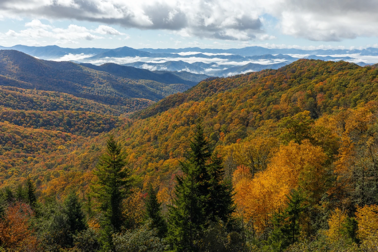

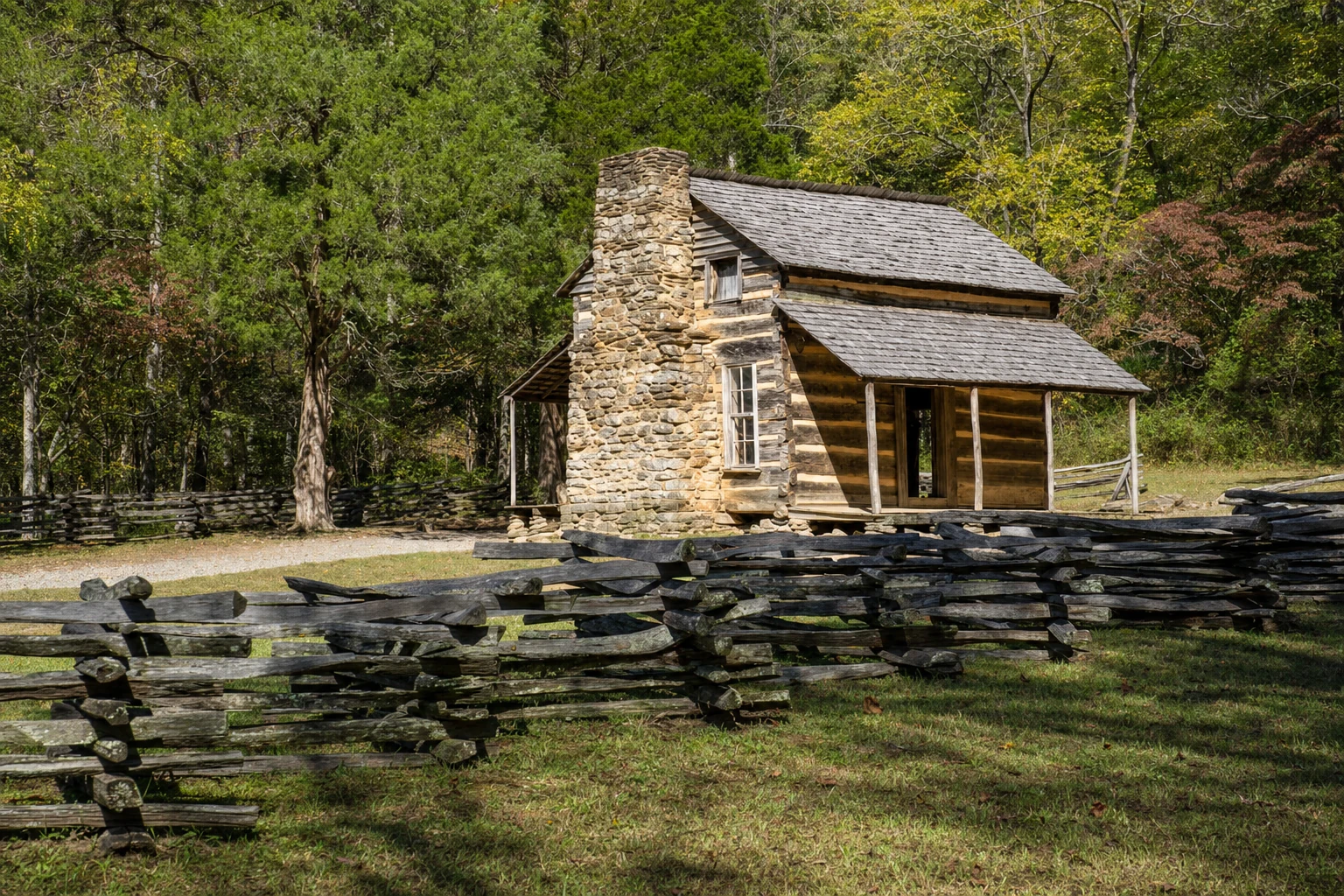
Cades Cove is an 11-mile one-way loop road threading a broad, flat valley encircled by peaks on the Tennessee side of Great Smoky Mountains National Park. It preserves one of the richest concentrations of 19th-century Appalachian architecture anywhere in the eastern United States — log cabins, three churches, a working grist mill, cantilever barns — alongside open fields that make it the park's single best place to see white-tailed deer, black bear, coyote, and wild turkey. The loop is designed to be driven slowly. Plan on two hours minimum; a full stop-at-everything tour easily stretches to four or five.
The preservation story
Unlike most national parks carved out of federal land, Great Smoky Mountains was assembled by purchasing over 6,000 private tracts through a decades-long effort funded partly by Tennessee, partly by North Carolina, and famously bolstered by a Rockefeller family donation. For the families living in Cades Cove, the park's creation in the 1930s meant selling their land and relocating. At its mid-19th-century peak the Cove's population exceeded 600 — a genuine self-sufficient community with its own churches, mills, and schools.
A handful of residents negotiated lifetime leases. The most famous were the Walker Sisters — Polly, Martha, Nancy, Louisa, and Caroline — five unmarried sisters who held onto their 122-acre Little Greenbrier homestead, farming, spinning, and weaving in the old way until the last of them, Louisa, died in 1964. Their cabin sits outside the Cove proper, but their story haunts the valley: independence, deep attachment to a specific piece of ground, and the bittersweet compromise that preserved the buildings you see today.
Mile by mile around the loop
The entrance drops you immediately into open pasture framed by the crest of the Smokies. The loop is one-way, gentle grade, paved the whole way.
- Mile 0.2 — John Oliver Cabin. One of the oldest structures in the park, built in the early 1820s. John and Lucretia Oliver were among the first permanent European settlers in the Cove. Single-pen log construction, hand-hewn timber, a short level walk from a small pullout. Step inside and the scale of early pioneer living becomes visceral.
- Mile 2.0 — Primitive Baptist Church. Established 1827. Unpainted clapboard, austere interior, a cemetery of weathered headstones chronicling generations of Cove residents. Plainness was the point of the Primitive Baptist doctrine.
- Mile 2.8 — Methodist Church. Built 1826, rebuilt 1901. The slightly more ornate interior and pulpit reflect the theological drift that had pulled a congregation out of the Primitive Baptist fold.
- Mile 3.3 — Missionary Baptist Church. Built 1839, rebuilt 1915. Another splinter from the Primitive Baptists, this one over whether to support missionary work. Visiting all three churches back-to-back is a compressed seminar in frontier religious life.
- Mile 5.0 — Abrams Falls trailhead. A five-mile round trip, moderately strenuous, through old-growth forest along Abrams Creek. The falls themselves are only about 20 feet tall but push an enormous volume of water into a deep pool. Allocate three to four hours; several stream crossings, sturdy footwear required.
- Mile 5.5 — Cades Cove Visitor Center and Cable Mill. The halfway point and the cultural heart of the loop. Restrooms, gift shop, ranger programs, interpretive exhibits. Built by John Cable in 1868, the Cable Mill still grinds corn and wheat when staffed during peak season. Around it: a barn, smokehouse, blacksmith shop, and the Becky Cable House — all relocated from elsewhere in the Cove to build out the sense of a working farmstead.
- Mile 6.8 — Henry Whitehead Place. Built 1898. A later-period complex featuring a large log cabin and a cantilever barn, the distinctive Appalachian form in which the upper story overhangs the foundation on all sides for hay storage and livestock shelter. The Whitehead family was among the last to leave when the park was established.
- Mile 7.5 — Dan Lawson Place. Built 1856. Combines log and frame construction, indicating both a shift in building technique and a degree of prosperity. Lawson was farmer, blacksmith, and cooper; the property includes a smokehouse and corn crib reflecting that diversified skill set.
- Mile 8.1 — Tipton Place. Built in the 1870s. A substantial homestead — two-story log house, cantilever barn, blacksmith shop, and a still house, the last of which hints at the less-documented role of moonshining in Cove economics.
- Mile 8.5 — Carter Shields Cabin. Built in the 1880s for a Civil War veteran. A small single-pen log cabin with a detached kitchen, often ringed by wildflowers in late spring, and one of the most-photographed structures on the loop.
- Mile 9.5 — Gregory Bald / Rich Mountain Loop trailhead. Backcountry access for serious hikers. Gregory Bald is famous for flame azalea blooms in late June, a pilgrimage among wildflower photographers. The Rich Mountain Loop is long and genuinely strenuous.
- Mile 10.0 — Rich Mountain Road exit. One-way and unpaved, leading out toward Townsend. Seasonally closed from roughly November through late spring.
- Mile 10.5 — Parson Branch Road exit. Another one-way unpaved exit toward Townsend. Closed for years after storm damage, reopened in 2022 after extensive repairs, and still subject to winter closure and periodic weather-related shutdowns. Narrower and more remote than Rich Mountain. Always verify status on the NPS site before committing to this exit.
Wildlife viewing
Cades Cove is the park's single best place to see large mammals because the open fields give them somewhere to browse in plain view.
- White-tailed deer are abundant, often grazing in the fields at dawn and dusk. Sightings are essentially guaranteed on a sunrise loop.
- Black bears are the headline draw. Dawn and dusk produce the best odds, with spring (mothers with cubs foraging) and fall (bears fattening before denning) the peak seasons. Federal regulation requires staying at least 50 yards from bears — never closer, never feed them, and never block a bear's line of retreat.
- Coyotes show up at dawn and dusk in the open fields, sometimes hunting in singles or pairs.
- Wild turkeys are everywhere along the forest edges, strutting in the fields during spring breeding season.
- Bobcats are present but rarely seen — camouflage and caution keep them out of sight. Patient observers at dawn occasionally get rewarded.
The hours right after sunrise and the last hour before sunset are the most productive for wildlife viewing, and the same hours produce the best light for photography. Traffic is also lightest then.
The vehicle-free bicycle mornings
To give cyclists and walkers the Cove without the cars, the loop closes to vehicles on Wednesdays from early May through late September, sunrise until noon. This has become one of the signature Smokies experiences — 11 miles of flat valley road, open fields on both sides, wildlife more relaxed without engine noise, no oncoming traffic to worry about. Bicycle rentals are available near the loop entrance. Exact 2025-2026 dates and times are published on the NPS Cades Cove page; verify before planning a trip around them.
Park-It-Forward parking tags
Since March 2023, every vehicle parking more than 15 minutes anywhere in Great Smoky Mountains National Park — including all Cades Cove pullouts and the Abrams Falls trailhead lot — must display a valid parking tag. Options are $5 per day, $15 per week, $40 per year, purchased online through recreation.gov or at visitor centers in advance. There is no entrance fee to the park itself; the parking program funds operations and maintenance. Ranger enforcement on the loop is active, especially in fall.
Photography through the loop
Cades Cove rewards patience with the weather. A clear blue-sky noon renders the churches and cabins as static postcards. Morning fog settling into the valley floor — a common late-summer and autumn phenomenon after a cool clear night — transforms the same scene. Shoot the John Oliver Cabin or the Carter Shields Cabin with mist threading the field behind them and the result is the archetypal Smokies photograph. Golden hour at the Cable Mill, with afternoon light angling through the millrace, produces the cleanest version of that iconic scene. For wildlife, a 300mm lens minimum keeps you legal distance while still filling the frame.
How to plan a visit
Arrive at the loop entrance no later than 7 AM if you want smooth passage; by 9 AM on summer and fall weekends traffic on the loop can crawl for hours behind a single stopped car watching a bear. Pack a full picnic for the Cades Cove Picnic Area beside the Visitor Center — tables and grills under shade, ideal for breaking the loop into two halves. Expect spotty to nonexistent cell service; download maps offline. Restrooms exist only at the loop entrance and the Visitor Center halfway around, so plan accordingly. Bus tours from Gatlinburg and Townsend run daily during peak season and remain the easiest option for visitors who want the history and wildlife without the driving.
When to come
The Cove reads differently in every season, and the choice of month changes the experience more than most visitors anticipate.
- Late spring (late April-May): dogwoods and wildflowers bloom along the loop edges, the fields fill in green, and cubs-of-the-year start to follow mothers through the fields. Pleasant temperatures, manageable crowds, and long light windows for photography.
- Summer (June-August): warm, humid, green. Bike mornings on Wednesdays peak. Wildlife viewing is best at the bookends of the day; midday the animals are in the woods and the light is flat.
- Early fall (late September-early October): temperatures drop, crowds have not yet surged, and early color starts to touch the ridges surrounding the Cove.
- Peak fall (mid to late October): the Cove enters its most-photographed window, with sugar maples and red maples igniting the field edges. This is also its busiest window. Weekends are better skipped entirely in favor of a Tuesday or Wednesday.
- Winter (December-February): the loop remains open, the fields lie bare, and elk and deer become highly visible against the empty landscape. Coldest mornings produce fog over the creek that photographers travel for.
A first visit deserves a full day — enter at dawn, complete one loop, break for lunch at the picnic area, and take a second slow loop in the afternoon. The return pass always reveals things the first drive missed.