
Three days gives you enough time to cover the park's signature terrain on both the Tennessee and North Carolina sides without rushing every morning. Base yourself in Gatlinburg for all three nights unless you're spending Day 3 in Cataloochee, in which case a night in Maggie Valley eliminates a long early-morning drive.
Day 1: Newfound Gap and Kuwohi
Leave Gatlinburg no later than 7:30 a.m. Newfound Gap Road fills quickly by 9 on most summer weekends, and parking at the gap itself gets competitive fast. The gap sits at 5,046 feet; stop, get your bearings, and read the state-line marker before continuing the 7-mile spur road up to Kuwohi (officially renamed from Clingmans Dome in 2024). At 6,643 feet, Kuwohi is the highest point in the park, and the half-mile paved walk to the observation tower delivers views that stretch 100 miles on a clear day. Bring a layer. Even in July, wind chill at that elevation surprises first-timers.
After Kuwohi, backtrack slightly and take the Forney Ridge Trail to Andrews Bald: 1.8 miles moderate to one of the park's few grassy balds. Open sky replaces the dense spruce-fir canopy, and the views north are wide. Plan an hour and a half round-trip, and pack your lunch here since there are no food vendors anywhere on Newfound Gap Road.
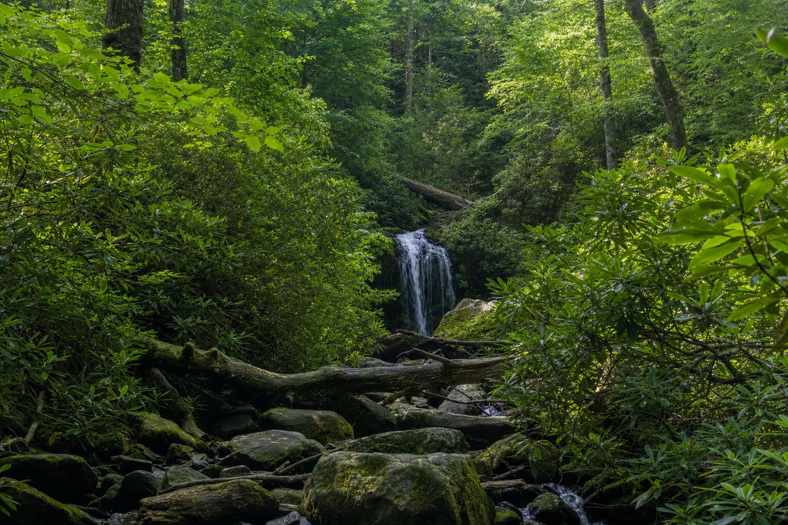
On the way back down toward Gatlinburg, pull into the Chimney Tops Overlook for a clear look at the twin summits. If you want a short waterfall walk in the afternoon, the Grotto Falls Trail off Roaring Fork Motor Nature Trail runs 2.6 miles round-trip with moderate elevation. Laurel Falls is more accessible from the main road but draws heavy crowds; Grotto Falls is the quieter choice.
For dinner, Calhoun's on the River handles BBQ and American comfort food reliably. Cherokee Grill runs higher-end steaks if you want something more substantial. Stop at Donut Friar before or after for pastries worth the detour.
Parking note: Designated trailheads throughout the park require a Park-It-Forward tag on your dashboard during peak season. Pick one up at any park visitor center or through recreation.gov. The fee funds park maintenance directly.
Day 2: Cades Cove and Roaring Fork
Cades Cove Loop is an 11-mile one-way road circling a broad valley ringed by ridgelines, and it's the best single location in the park for spotting white-tailed deer and black bear. Arrive at the loop entrance by 8 a.m. on weekdays. On Wednesdays and Saturdays, the park restricts the loop to foot and bicycle traffic before 10 a.m., so vehicles aren't admitted during that window; check the NPS site before you go.
Work through the loop and slow at the notable historic stops. The Cades Cove Methodist Church appears within the first mile, one of the better-preserved 19th-century structures in the park. Cable Mill sits around mile 5.5, where an operating grist mill and original outbuildings give you the clearest sense of how self-sufficient this community was before the park was established. The Carter Shields Cabin near mile 9.5 marks where the valley narrows back toward forest. Bear sightings cluster along the tree line in the mornings, so watch the field edges.
Abrams Falls Trail starts near the Cable Mill parking area, running 5 miles round-trip with creek crossings and a descent to the falls and its deep plunge pool. Plan two to three hours. If you'd rather skip the long hike, drive to Townsend and pick up the Roaring Fork Motor Nature Trail from the Gatlinburg side.
Roaring Fork is a one-way motor trail through old-growth forest with historic cabin pullouts scattered at regular intervals. The Alfred Reagan Place is the standout stop: a late 19th-century homestead with a tub mill and brightly painted outbuildings that make it the most visually distinct site on the trail. Rainbow Falls Trail starts from Roaring Fork, putting the 80-foot falls 2.7 miles in.
For dinner, Bennett's Pit Bar-B-Que on Parkway in Gatlinburg handles the post-hike crowd without long waits. Atrium Pancakes works if you're eating late or on an irregular schedule.
Day 3: Cataloochee Valley or Towns
Option A: Cataloochee. This is the right call for anyone who wants to see elk. The valley sits on the North Carolina side, about 90 minutes from Gatlinburg via I-40; take the interstate, not the shorter-looking Cove Creek Road approach unless you're comfortable on unpaved one-lane roads. Arrive by 8 a.m. for the best chance at spotting elk in the open fields near the Caldwell House. The Beech Grove School a few hundred yards up the road is one of the most intact one-room schoolhouses in the park. For hiking, the Caldwell Fork Trail covers 5.7 miles of moderate hardwood forest along a stream. The Boogerman Trail at 7.1 miles adds more elevation and significantly fewer people. If you stay for evening elk viewing, leave before dark; the narrow access road is challenging once the light drops.
Option B: Gatlinburg and the crafts loop. After two hard hiking days, a slower pace makes sense. The Gatlinburg Arts & Crafts Community runs as an 8-mile loop road east of downtown with working studios: glassblowers, woodworkers, weavers, potters. It reads nothing like the main tourist strip. Anakeesta runs a gondola up the ridge overlooking downtown, and the view is worth one visit. Ober Mountain operates year-round and runs an aerial tramway directly from the Parkway.
For a final dinner, Crockett's Breakfast Camp serves all day and is one of the more consistent options on the strip. Chesapeake's Seafood and Raw Bar runs higher price points but covers the gap for a real sit-down meal before the drive out.