
The Great Smoky Mountains support the largest wild elk herd in the eastern United States, a dense black bear population, and one of only a handful of synchronous firefly species found anywhere in the world. Seeing all three requires different seasons, different corners of the park, and more early-morning commitment than most visitors plan for. Days 1 through 3 of this itinerary are built around September and October for the elk rut; Day 4 is a standalone June add-on for the Elkmont firefly lottery, either as a separate trip or combined if your calendar allows.
Day 1: Arrive and Orient — Cherokee Base
Cataloochee Valley is the heart of the elk-watching operation, but the access road is a winding 11-mile gravel climb that takes longer than it looks on a map. Arrive before dark on Day 1. Check into lodging in Cherokee or set up camp at Cataloochee Campground, which requires advance reservations on Recreation.gov.
Before heading into the valley, stop at the Museum of the Cherokee People on US-441 in Cherokee — the exhibit on Cherokee land and the 19th-century removal gives useful context for everything you'll see in the park. Mingo Falls is a 120-foot drop accessible from a 0.15-mile walk off Big Cove Road and an easy afternoon stop before the drive in.
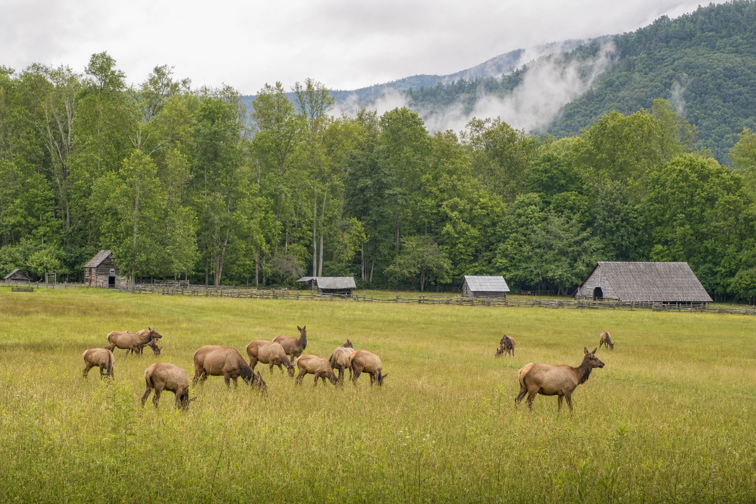
Arrive at the Cataloochee meadows by 5:30 p.m. Pull off at one of the roadside turnouts near the Caldwell House or along Palmer Creek Road. Do not walk into the open meadow or approach any animal. During the rut, bull elk are actively herding cows and can cover ground far faster than people expect. Federal regulation requires at least 50 yards of distance from elk at all times, and during the rut that buffer is both a legal requirement and a practical one — a bugling 700-pound bull at 60 yards is not a photo opportunity, it's a hazard. Stay at or near your vehicle. Dinner back in Cherokee after dark; Cork & Bean Bistro handles a post-sunset meal well.
Day 2: Cataloochee at Dawn + Oconaluftee
Set an alarm for at least an hour before sunrise. Elk are most active in the last hour of darkness and the first hour of light, and dawn during the October rut means bugling bulls, scent-marking, and actual sparring if the herd size is right. Park at the valley lot and walk the area near the Caldwell Fork Trail trailhead, where the meadow views have produced consistent rut activity for years. You'll hear before you see.
After the morning session, hike Caldwell Fork Trail itself if legs allow — 5.7 miles round trip through old-growth hardwood forest, moderate grade, good for deer and woodland birds once the elk have settled.
Afternoon: drive north to Oconaluftee Visitor Center on US-441. The meadow alongside the Oconaluftee River adjacent to the visitor center is a second reliable elk spot, with flat walking and easy parking. The Mountain Farm Museum here costs nothing beyond park admission and is worth 30 minutes. Pick up a Park-It-Forward hang tag at the visitor center if you don't have one yet; roadside stops along Newfound Gap Road require it. Move your base to Gatlinburg tonight if you prefer — it positions you better for Days 3 and 4. Atrium Pancakes works for a late dinner or tomorrow's breakfast.
Day 3: Cades Cove and Roaring Fork — Bears
Cades Cove is the single best location in the park for black bears, but the advantage belongs to early arrivals. The one-way 11-mile loop opens at sunrise, and bears are most visible in the first 90 minutes before the cove fills with vehicles. The open meadow sections near Cable Mill and around Carter Shields Cabin are the most productive spots; most first-time visitors drive past a bear because they're watching the road rather than the field edges. Go slowly. Binoculars are not optional here.
Allow two to three hours for the loop depending on traffic, then consider Abrams Falls Trail — five miles round trip from the trailhead near the campground, ending at a broad 20-foot waterfall that rewards the walk. Lunch in Gatlinburg: Bennett's Pit Bar-B-Que on Historic Nature Trail is filling and quick.
Afternoon: Roaring Fork Motor Nature Trail, accessed from downtown Gatlinburg, winds through old-growth forest past Alfred Reagan Place and several stream crossings where bears move regularly, especially in fall when berry crops are heavy in the creek drainages. The road is narrow, one-way, and closes in winter — it's reliably open through October. Grotto Falls Trail branches off at the Trillium Gap trailhead: 2.6 miles through hemlock forest to a waterfall you walk directly behind. Coffee & Company in Gatlinburg handles an early dinner or post-hike coffee.
Day 4 (June Only): Elkmont Synchronous Fireflies
The synchronous firefly display at Elkmont runs for roughly two weeks each June — the exact peak shifts by year based on temperature, usually falling somewhere between late May and mid-June. The National Park Service posts a predicted peak window on the GSMNP website about one to two weeks in advance.
Access requires a shuttle ticket purchased through a paid lottery on Recreation.gov, which typically opens in late April or early May. Tickets sell out within minutes. Book immediately when the lottery opens.
On the evening of your reservation, park at Sugarlands Visitor Center and board the shuttle to Elkmont Campground. Walk roughly a mile along the old Appalachian Club road to the viewing area — arrive before dark to get a position and let your eyes adjust. Bring only a red-filtered flashlight; white light disrupts the display and ruins the experience for everyone around you. The synchronization builds in waves across the hillside: one male flashes, neighboring males respond, and within a few minutes the entire slope is pulsing in coordinated sequences. It runs for 45 minutes to an hour.
For the day before the evening: Laurel Falls Trail — 1.3 miles paved from the trailhead on Little River Road to an 80-foot two-tiered waterfall — keeps the legs moving without wearing you out ahead of the late night. Donut Friar in Gatlinburg is the right call for breakfast.