
Columbia to Gatlinburg runs about 240 miles and takes roughly 4 hours under normal conditions, putting the Smokies firmly in overnight-trip territory for South Carolina travelers. The drive is straightforward, and the scenery improves considerably once you clear Asheville, making the journey feel shorter than the map suggests. Plan for an afternoon arrival; the gateway towns get busy on Friday evenings, and you'll want daylight for your first look at the mountains.
The drive from Columbia
Take I-26 West out of Columbia and follow it all the way to Asheville, about 165 miles. From Asheville, pick up I-40 West into Tennessee; most travelers exit toward Gatlinburg via US-321 North through Sevierville. The route is well-marked and never confusing, though the I-26 corridor tends to slow around Spartanburg during commute hours. If you're leaving Columbia on a Friday after work, build in an extra 20 to 30 minutes for that section.
The I-40 leg from Asheville runs through the Pigeon River Gorge before crossing into Tennessee, a stretch that's genuinely scenic even on a gray day. Door-to-door from Columbia to Gatlinburg is about 4 hours without stops.
Flying is rarely worth it for this distance. Columbia Metropolitan (CAE) connects through Charlotte or Atlanta, and by the time you factor in a layover, a rental car pickup in Knoxville, and a 45-minute drive to Gatlinburg, you haven't saved meaningful time over just driving.
How long to plan for
At 240 miles each way, this isn't a day trip. A round trip is 480 miles; leaving Columbia at 6am and driving home after dark would buy you maybe 5 hours on the ground for 8 in the car. Plan a weekend minimum, ideally three nights. Two nights gives you one full day in the park and an evening to walk the Gatlinburg Parkway; a third night lets you add Cades Cove or a drive to the North Carolina side.
A full week is worth it if the Smokies are the sole destination. Most visitors who book five or six nights end up wishing they had added one more day.
What to do when you arrive
The park charges no entrance fee, but any vehicle parked 15 minutes or more needs a Park-It-Forward parking tag: $5 for a day, $15 for a week, $40 for the year. Buy one at a self-serve kiosk near any major trailhead before you park.
Laurel Falls is the park's most-walked paved trail, short enough for most fitness levels and rewarding enough to explain the crowds. For something with more elevation, Alum Cave Trail covers 1,100 vertical feet in 2.5 miles to the cave bluffs, with the full route extending to Mount Le Conte. Abrams Falls is a 5-mile round trip off the Cades Cove loop road, ending at a wide waterfall with a deep pool below it. Roaring Fork Motor Nature Trail, a one-way loop off Airport Road in Gatlinburg, passes Grotto Falls and several old homesteads without requiring a long out-and-back hike.
The 11-mile Cades Cove loop is best driven early on a Wednesday or Saturday morning, when the road opens to cyclists and pedestrians before cars. Deer are common throughout; bears appear often enough that you should read the park's bear safety guidelines before your first trail.
On the North Carolina side, Bryson City offers whitewater access on Deep Creek and a ride on the Great Smoky Mountains Railroad; Cataloochee Valley, where the park reintroduced elk in 2001, is worth an evening drive in September or October for reliable sightings. For a break from the park, Dollywood in Pigeon Forge runs through late fall, and Anakeesta above Gatlinburg is accessible by gondola. Ripley's Aquarium of the Smokies on the Gatlinburg Parkway handles a rainy afternoon well.
Where to stay
Gatlinburg puts you closest to the main park entrance on the Tennessee side, within walking distance of the Parkway's restaurants and shops. Pigeon Forge is busier, better suited to families planning to split time between Dollywood and the park. Townsend, on the western edge, sits at the Cades Cove access road and sees a fraction of the Gatlinburg corridor's traffic. On the North Carolina side, Cherokee and Bryson City make more sense if Cataloochee, Deep Creek, or Newfound Gap Road is your focus.
The map below shows live cabin and hotel availability across all of these towns; filter by your check-in date for accurate pricing.
Best time to make the trip
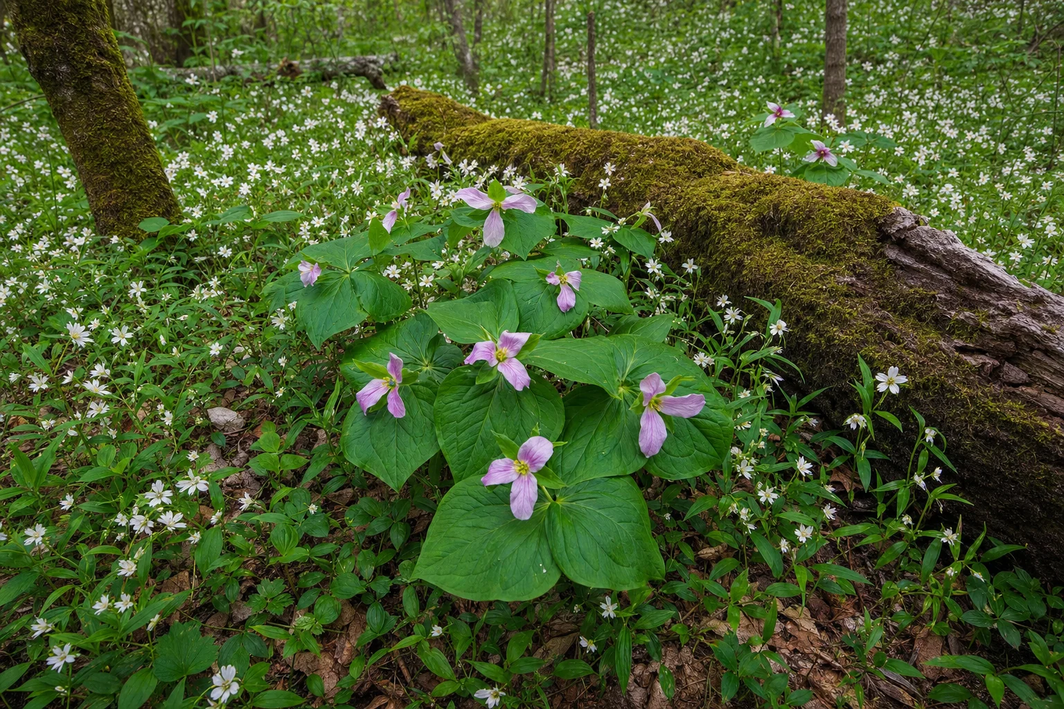
Summer is the park's peak season and its most congested. Parking at popular trailheads fills before 9am on weekends from June through August, and Newfound Gap Road can move as slowly as any main street through a busy tourist town. Spring is more manageable, with wildflower blooms running from late March through May. Fall is the most compelling season for many visitors: high-elevation foliage along Newfound Gap Road peaks in late September, with color moving to lower elevations through early November. Elkmont's synchronous fireflies run in late May to mid-June and require a lottery reservation.
Winter is underrated. The park empties, Kuwohi (Clingmans Dome, at 6,643 feet) closes from December through March, but lower trails stay open and clear days deliver longer sightlines than any other season.