
Indianapolis sits about 385 miles from Gatlinburg, which works out to roughly six hours of driving under normal conditions. That's a genuine commitment, not a casual afternoon out, but a Friday-night departure gets you into the Smokies before midnight and leaves a full Saturday and Sunday for the mountains.
The drive from Indianapolis
Take I-65 South out of Indianapolis to Louisville, then pick up I-40 East and stay on it through Knoxville. From Knoxville, follow US-441 South through Sevierville and into Gatlinburg; that last stretch is about 40 minutes and accounts for most of the trip's traffic variability. The interstate portion moves fast on weekdays, but weekend evenings near Sevierville can slow considerably once you exit I-40, particularly in summer and October. A Thursday night or early Friday morning departure is a meaningful improvement over arriving Friday evening.
How long to plan for
At nearly 400 miles each way, a day trip is not a workable option. You'd spend more time in the car than in the park, and even a full morning on the ground wouldn't be enough to hike Laurel Falls and back, much less drive Cades Cove. Two nights is the practical minimum that justifies the drive; you'll have Saturday and Sunday in the park without spending half your time behind the wheel. A three-night trip gives you room to visit both the Tennessee and North Carolina sides without rushing through either. If a full week fits your schedule, the park has enough variety to fill it.
What to do when you arrive
Gatlinburg is the main entry point from the Tennessee side, where the Parkway runs through downtown and several popular trailheads are within a short drive. Laurel Falls is one of the most-visited trails in the park: a paved 2.6-mile round trip to an 80-foot waterfall. Rainbow Falls and Grotto Falls both require more effort but draw noticeably fewer people by mid-morning, and the Alum Cave Trail is worth the time if elevation gain and geology in the same hike sounds appealing.
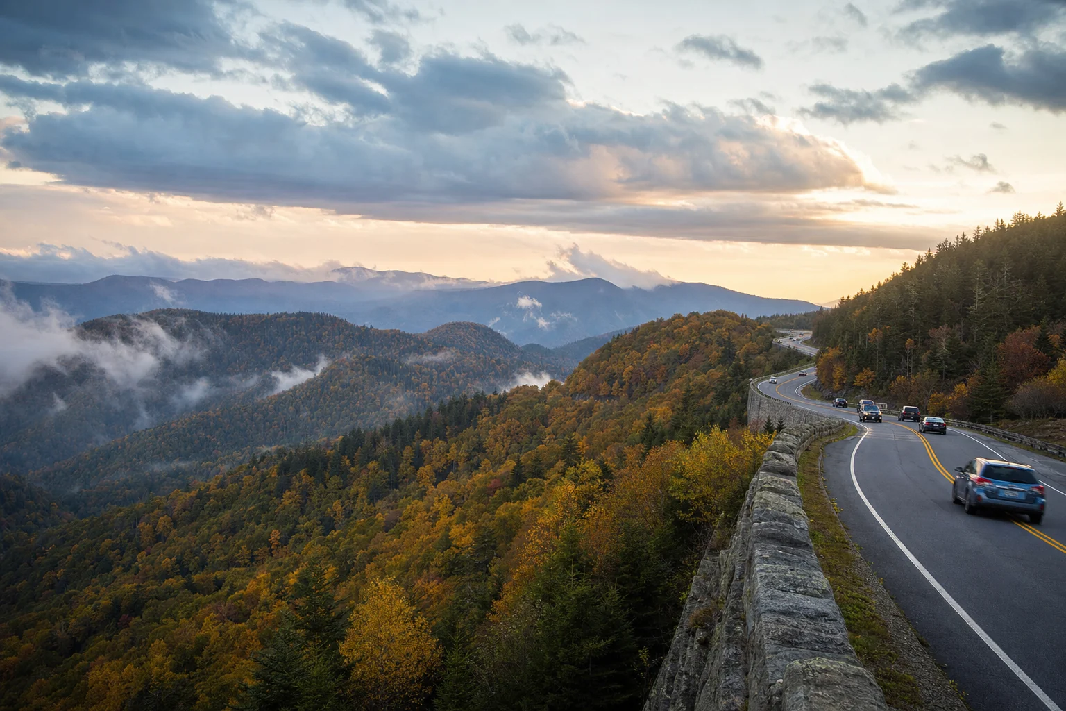
Newfound Gap Road crosses the park from Tennessee into North Carolina, climbing to 5,046 feet at the state line. The Kuwohi (Clingmans Dome) spur road branches off near Newfound Gap and reaches 6,643 feet, the highest point in the park; plan at least two hours for the drive up, the short paved walk to the observation tower, and the return. On the western side of the park, the Cades Cove 11-mile loop is the best wildlife-watching drive in the area, with deer and occasional bear most visible in the early morning.
Pigeon Forge, about 10 miles north of Gatlinburg, has Dollywood, which is worth a full day on its own. Anakeesta and the Gatlinburg SkyLift Park both work well for an afternoon, and Ripley's Aquarium of the Smokies stays open year-round as a solid option on rainy days.
Any vehicle parked inside the park for 15 minutes or longer requires a Park-It-Forward tag: $5 for a day, $15 for a week, $40 for a year. There's no entrance fee for the park itself. If you plan to stop at multiple trailheads across several days, the annual tag pays for itself quickly.
For the North Carolina side, Bryson City puts you close to Deep Creek and the Great Smoky Mountains Railroad. Cherokee, on the Qualla Boundary, has consistent elk sightings near the Oconaluftee Visitor Center in morning and evening hours.
Where to stay
Gatlinburg and Pigeon Forge have the highest concentration of cabins, hotels, and vacation rentals and sit closest to the most-visited trailheads. Townsend, on the quieter western Tennessee side, is the better base if Cades Cove is your main interest. Bryson City and Cherokee serve the North Carolina end of the park. Fall foliage weekends in October book up weeks or months ahead; if that's your target window, reserve early. The map below shows live rates and availability across all of these areas.
Best time to make the trip
Summer draws the largest crowds, and popular trailhead parking areas can fill before 9am on weekends. The trails and waterfalls are fully accessible and the park is in full leaf, but expect company everywhere. Fall is the most popular overall season: high-elevation color starts in late September, mid-elevation peaks through mid-October, and lower-valley foliage carries into early November. Fall weekdays are noticeably calmer than weekends despite the season's reputation. Spring, from late March through May, brings wildflower blooms and moderate weather without the summer volume; some higher-elevation roads may still be closed from winter damage into April. Winter is the least-visited season by a significant margin and the only time you can reliably find solitude on trails like Alum Cave or Andrews Bald, though Newfound Gap Road and the Clingmans Dome road close periodically when ice and snow make them impassable.