
The drive from Lexington to Gatlinburg covers about 225 miles and takes roughly 3 hours and 45 minutes under normal traffic, making this a solid but manageable drive you can knock out in a morning. It's too far for a day trip without feeling rushed on both ends — plan for at least a full weekend, and you'll actually have time to see something worth the miles.
The drive from Lexington
I-75 South is the backbone of the route. You'll follow it through Corbin, cross into Tennessee, and continue into Knoxville, where you pick up I-40 East briefly before turning south on US-441. That last stretch on US-441 carries you through Sevierville and Pigeon Forge before hitting Gatlinburg and the park entrance; expect strip traffic and billboard country before any mountain scenery. Budget an extra 20-30 minutes on summer weekends and throughout October, when the Pigeon Forge corridor backs up reliably. A 6 a.m. Friday departure from Lexington gets you into Gatlinburg before lunch, ahead of both the midday congestion and the worst of the trailhead parking situation.
Blue Grass Airport (LEX) has regional connections to a few hubs, but flying into Knoxville and renting a car rarely saves time or money compared to the 3-hour-45-minute drive. For most people coming from Lexington, driving is the straightforward call.
How long to plan for
At 225 miles one way, this is not a day trip. The round-trip drive alone runs about 7.5 hours, leaving maybe four or five hours on the ground — enough to walk one trail and eat a meal, not enough to feel like you went anywhere. Two nights is the minimum that makes the miles feel worthwhile; you get two real days in the park. Three nights is better: one day on Newfound Gap Road with a longer hike, one day in Cades Cove or across the ridge into Cherokee, and one day for whatever Pigeon Forge or Gatlinburg you want before heading home. A full week opens the North Carolina side — Bryson City, Deep Creek, Cataloochee Valley — which most Kentucky visitors skip entirely and which rewards the extra time.
What to do when you arrive
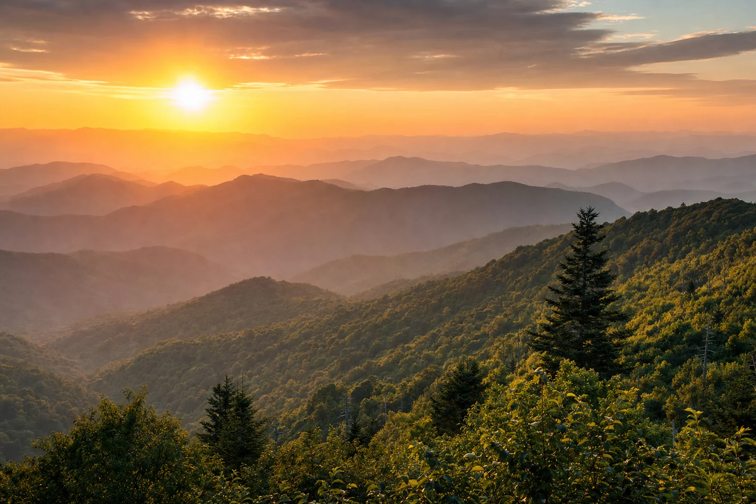
Newfound Gap Road (US-441 through the park) is the place to start: it crosses the state line at 5,046 feet and gives you a fast sense of what the Smokies are actually like. A spur at the top climbs to Kuwohi, formerly called Clingmans Dome, at 6,643 feet, the highest point in the park. That parking lot fills by 9 a.m. on summer weekends.
For trails, Laurel Falls is the most-visited waterfall in the park and stays accessible most of the year. Abrams Falls in Cades Cove is five miles round-trip; the falls are wider than they are tall, which surprises people who expect a vertical drop. Alum Cave Trail has an arched rock bluff about two miles in that's worth the climb on its own, and the full route to LeConte is one of the better all-day hikes on the Tennessee side.
The park charges no entrance fee, but a Park-It-Forward parking tag is required for any vehicle stopped 15 minutes or longer at a trailhead lot. Day pass is $5, weekly is $15, annual is $40. Buy at kiosks near trailheads or in advance on the park's website.
Outside the park: Anakeesta in Gatlinburg sits on a ridge above downtown and offers solid mountain views without a strenuous hike. Ripley's Aquarium of the Smokies is genuinely well done and a useful option on a rain day. Dollywood in Pigeon Forge earns a full day if you have any interest in theme parks — it handles Appalachian craft demonstrations and roller coasters in the same park, and it does both well.
Where to stay
Gatlinburg puts you closest to the main Tennessee park entrance, with trailheads a few minutes away; it books out far in advance for October. Pigeon Forge has more lodging across more price points and sits about ten minutes from the entrance — louder and more commercial, but the selection helps when Gatlinburg is full. Townsend, on the southwestern side, sits right at the Cades Cove access road and skips the strip traffic entirely; it's the right base if your priority is the park rather than the entertainment district. On the North Carolina side, Bryson City has grown its options considerably and puts you close to Deep Creek and the Great Smoky Mountains Railroad. Compare live cabin and hotel rates across all of these on the map below.
Best time to make the trip
Summer (June through August) is peak season: all roads and facilities open, high elevations stay comfortable even when the valleys hit the 80s, and everything is crowded. Arrive at trailhead parking by 8 a.m. or accept a long walk from overflow.
Fall draws the biggest crowds for good reason. Color starts at the high elevations in late September and works down through mid-October into early November, with peak color at mid-elevations usually landing in mid-to-late October. It's the most expensive and most booked window of the year; if you're going in October, plan months ahead.
Spring runs late March through May and brings wildflowers at lower elevations, waterfalls running high from snowmelt, and noticeably smaller crowds than either summer or fall. The synchronized firefly event at Elkmont in late May or early June requires a lottery permit but is worth applying for if you're flexible on dates.
Winter is genuinely quiet. Cades Cove stays open, main roads clear after ice, and cabin prices drop by a third or more compared to fall peak.