
About Alum Cave Trail to Mount LeConte
Most day hikers pick this trail for the bluffs and turn around; only a fraction push on to the summit. Both choices are worth making, but they're genuinely different hikes with different demands, and conflating them sends a lot of unprepared people scrambling to the summit or turning back disappointed well before the real payoff.
Two hikes, one trailhead
Alum Cave Trail splits into two distinct objectives. Go 2.5 miles one-way (5 miles round trip) and you reach Alum Cave Bluffs: a massive rock overhang that projects out over the trail, dry underneath even in heavy rain, with 1,200 feet of elevation gain. That's the moderate version: challenging enough to feel earned, accessible to fit hikers across a wide range of experience.
Push past the bluffs for another 2.5 miles and you're on the strenuous version — 5 miles one-way, 10 miles round trip, to the summit of Mount LeConte, the third-highest peak in the park, with a total climb of 2,800 feet. The upper section features fixed cable handrails along exposed ridge sections where the trail narrows and the drop-offs get real. If you're not comfortable with hands-and-knees scrambles while wearing a loaded pack, be honest about that before you leave the car.
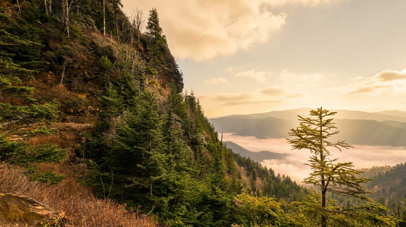
What the trail is actually like
For the first mile and a half, the path runs alongside Alum Cave Creek through old-growth forest, gaining elevation gradually enough that you might underestimate what's coming. At roughly 1.3 miles, Arch Rock appears: a natural tunnel hollowed out of the sandstone by water erosion, steep stone steps cut through its center. It's the sharpest single grade change on the lower half of the trail.
Alum Cave Bluffs arrive at the 2.2-mile mark. The scale is harder to convey than any photo manages — the overhang stretches for hundreds of feet and rises perhaps 80 feet above the trail, its underside streaked with mineral deposits (the "alum" refers to an alum mineral residue, not anything hazardous). On rainy days, standing under it while the forest drips around you is one of the better experiences in the park, full stop.
Above the bluffs, the trail gets serious. You pass through Inspiration Point, where views open to the east and north, and then the upper ridge narrows and the cables begin. These aren't optional handholds; they're anchored into rock faces you'd genuinely struggle to navigate without them. The final approach to LeConte Lodge is relentless — no false summits, but no mercy either.
When to go
Fall gets the most attention, and the crowds match the reputation. Foliage on the upper elevations typically peaks in mid-October, with lower elevations following by late October. It's the most visually rewarding time to hike but also the hardest to get a trailhead parking spot after 8am.
Spring is underrated, especially on weekdays. Wildflowers carpet the lower slopes from late March through May depending on elevation, waterfalls along the creek run hard, and the upper trail is far less crowded than in fall.
Summer means early starts. The parking area fills by 9am most weekends, and afternoon thunderstorms build reliably at summit elevation; if you're headed to Mount LeConte, plan to be off the upper ridge by early afternoon.
Winter offers something the other three seasons can't: genuine solitude, ice-rimmed rocks at the bluffs, sharp long views free of haze, and a quiet that makes the trail feel like a different place entirely. The tradeoff is real — the trail becomes treacherous with ice above 4,000 feet, microspikes are non-negotiable in January or February, and Newfound Gap Road can close in heavy snowstorms.
Getting there
You'll find the trailhead on Newfound Gap Road (US-441), about 8.6 miles from the Sugarlands Visitor Center outside Gatlinburg. From downtown, allow 20-25 minutes; it's a winding mountain climb with enforced speed limits, and traffic backs up on busy mornings.
All vehicles parking inside the park for more than 15 minutes need a Park It Forward parking tag: $5 per day, $15 per week, or $40 for an annual pass. Buy one at recreation.gov, through the park's mobile app, or at kiosks near the entrance. The trailhead lot has limited spots, and overflow parking along the road gets tightly managed on peak weekends. Arriving by 7am is a genuine cushion if you're planning a full-day summit push.
Staying at LeConte Lodge
LeConte Lodge operates from roughly mid-March through late November, accessible only by foot — Alum Cave Trail is the shortest route. Accommodations run to rustic cabins and lodge rooms, with dinner and breakfast included, which matters because there's nowhere else to eat at 6,593 feet.
Reservations open a year in advance and typically fill within hours of the booking window. If an overnight on LeConte is something you want, mark the reservation date and treat it like tickets to a show that sells out in minutes. The lodge publishes exact opening dates annually, and those dates shift slightly year to year. Cancellations do free up spots, so checking back is not pointless.
Before you leave the trailhead
Carry more water than you think you'll need. The trail has no reliable potable sources unless you filter from the creek, and the climb to the summit in warm weather will drain a hydration reservoir faster than most people expect. Summit temperatures run 10-15 degrees cooler than the valley; wind on the upper ridge can drop the effective temperature further with little warning, so a rain layer and an insulating layer belong in your pack regardless of what the forecast says at lower elevation.
Black bears use this corridor regularly. Keep food and scented items secured in your vehicle or a bear canister, and if you encounter one on the trail, give it a minimum of 50 yards; don't approach even if it appears indifferent. Cell coverage disappears above the first mile and doesn't return until you're back in the valley, so let someone know your itinerary before you start.
Frequently asked questions
- How long is Alum Cave Trail to Mount LeConte?
- Alum Cave Trail to Mount LeConte is 5 miles one-way (10.0 miles round-trip), with 1,200 feet of elevation gain. It is rated moderate.
- Do I need a parking tag?
- Yes — a Park It Forward parking tag is required for vehicles parked more than 15 minutes anywhere inside Great Smoky Mountains National Park. Daily ($5), weekly ($15), or annual ($40) tags are available via recreation.gov or park kiosks.