
About Balsam Mountain Trail
Getting to Balsam Mountain Trail requires more planning than most Smokies hikes. You don't arrive from Sugarlands Visitor Center; you take the Blue Ridge Parkway to milepost 458 near Cherokee, North Carolina, then drive Heintooga Ridge Road — narrow, paved, winding — up to the campground that serves as the trailhead. The road opens seasonally, typically late May through October, and outside that window there's no access at all. That natural filter keeps the trail uncrowded, and the high-elevation spruce-fir forest you end up hiking through feels genuinely removed from the busier corridors of the park.
What the Trail Involves
5.8 miles, a loop configuration, 1,300 feet of elevation gain. NPS rates it strenuous, and that's not padding; the climbing is sustained across the route rather than concentrated in one steep pitch, which means you're working through most of the hike. Budget four to six hours for the full loop.
The trailhead sits at Balsam Mountain Campground (35.5898° N, 83.2120° W), a small, rustic facility far removed in character from the larger park campgrounds. Fewer amenities, fewer people, no reliable cell service. The forest itself is the main draw. At elevations above 5,000 feet, the lower-elevation hardwoods give way to spruce-fir, an ecosystem type that covers only the highest ridges and peaks in the Southern Appalachians. Cooler, more humid, botanically distinct from the oak-hickory forests that most visitors see. Canopy closes overhead, the understory thins, mosses and lichens coat the rocks and logs. On a hot summer day, expect temperatures to run 15 to 20 degrees cooler than the valley towns below; the difference is immediately obvious when you step out of the car at the trailhead.
Getting There
From the Tennessee side of the park, this is a substantial drive. Ninety minutes each way is a realistic minimum, not an optimistic best case. Head toward Cherokee, NC, pick up the Blue Ridge Parkway north to milepost 458, and turn onto Heintooga Ridge Road. It climbs to the Heintooga Picnic Area at roughly 5,400 feet elevation, then continues to Balsam Mountain Campground. The road is paved but narrow; passing requires care, and the winding descent back down takes concentration. Large trailers shouldn't attempt it.
Road access is seasonal, and this matters more than it might sound. Heintooga Ridge Road typically opens in late May and closes in October, but exact dates shift based on weather and conditions each year. Check the NPS website before you make the drive. Arriving to find a closed gate is a long wasted trip with no workaround.
A Park-It-Forward tag is required for any vehicle parked inside Great Smoky Mountains National Park for more than 15 minutes. Daily tags are $5, weekly $15, annual $40 — available at recreation.gov or on-site kiosks.
The Route
The 5.8-mile figure reflects the one-way distance to Pin Oak Gap; the loop returns via connecting trails, putting total hiking distance above that number. Pick up a current GSMNP trail map at a park visitor center before you go. The rangers at Oconaluftee Visitor Center in Cherokee can give you current conditions for this area, which gets checked far less frequently than the high-traffic sections on the Gatlinburg side. The Balsam Mountain network connects to other trail segments for longer outings, but for a first visit the loop itself is a full day's work.
When to Go
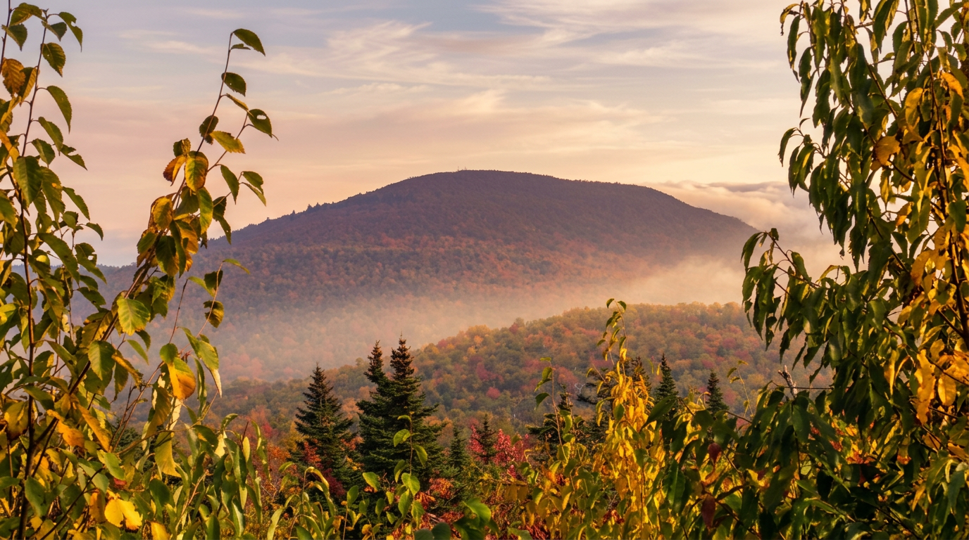
Late May into June delivers the first reliable road access of the season along with rhododendron bloom at high elevation. Summer works well here precisely because of the altitude; when heat is making lower-elevation trails miserable, this is one of the few places in the park where midday hiking stays tolerable. Fall draws visitors to the Heintooga Ridge Road overlooks, where surrounding ridges show strong color visible from pulloffs that rarely see more than a handful of cars. The spruce-fir forest itself doesn't turn the oranges and reds of the lower hardwoods, but the landscape context in October is worth the drive. Aim for mid-October for peak color in this part of the park.
There is no winter access. The road closes before serious conditions arrive, and there's no alternate approach to this trailhead.
Know Before You Go
Black bears are active throughout GSMNP. Keep 50 yards of distance, make noise on the trail to avoid surprise encounters, and never leave food unattended. At the campground, use designated bear storage; this is not optional.
Carry more water than you think you'll need. High-elevation hiking feels moderate until your legs disagree, and reliable water sources on the trail are not guaranteed. A rain layer and a warm layer belong in the pack regardless of the forecast; conditions at 5,000 feet can change fast and with little warning. Cell coverage here is poor at best. File a trip plan with someone before you leave, carry a paper map, and know that help is further away than on the more central park trails.
Who This Trail Is For
Experienced hikers who've already covered the park's well-known routes and want something different. If Alum Cave Bluffs felt crowded, if you want to get into high-elevation spruce-fir territory without fighting for trailhead parking, this is a strong choice. The combination of genuine remoteness, distinctive forest, and a route that doesn't appear on every Smokies top-ten list makes it one of the more worthwhile hikes in the park for people who know what they're doing.
First-time mountain hikers, families with young children, or anyone not comfortable with strenuous terrain should choose a different trail. The access drive is long, the hike is demanding, and assistance is far away if something goes sideways.
Frequently asked questions
- How long is Balsam Mountain Trail?
- Balsam Mountain Trail is 5.8 miles one-way, with 1,300 feet of elevation gain. It is rated strenuous.
- Do I need a parking tag?
- Yes — a Park It Forward parking tag is required for vehicles parked more than 15 minutes anywhere inside Great Smoky Mountains National Park. Daily ($5), weekly ($15), or annual ($40) tags are available via recreation.gov or park kiosks.