
Trail guide
Best Full-Day & Long Hikes in the Smokies
16 curated picks · verified 2026-05-28
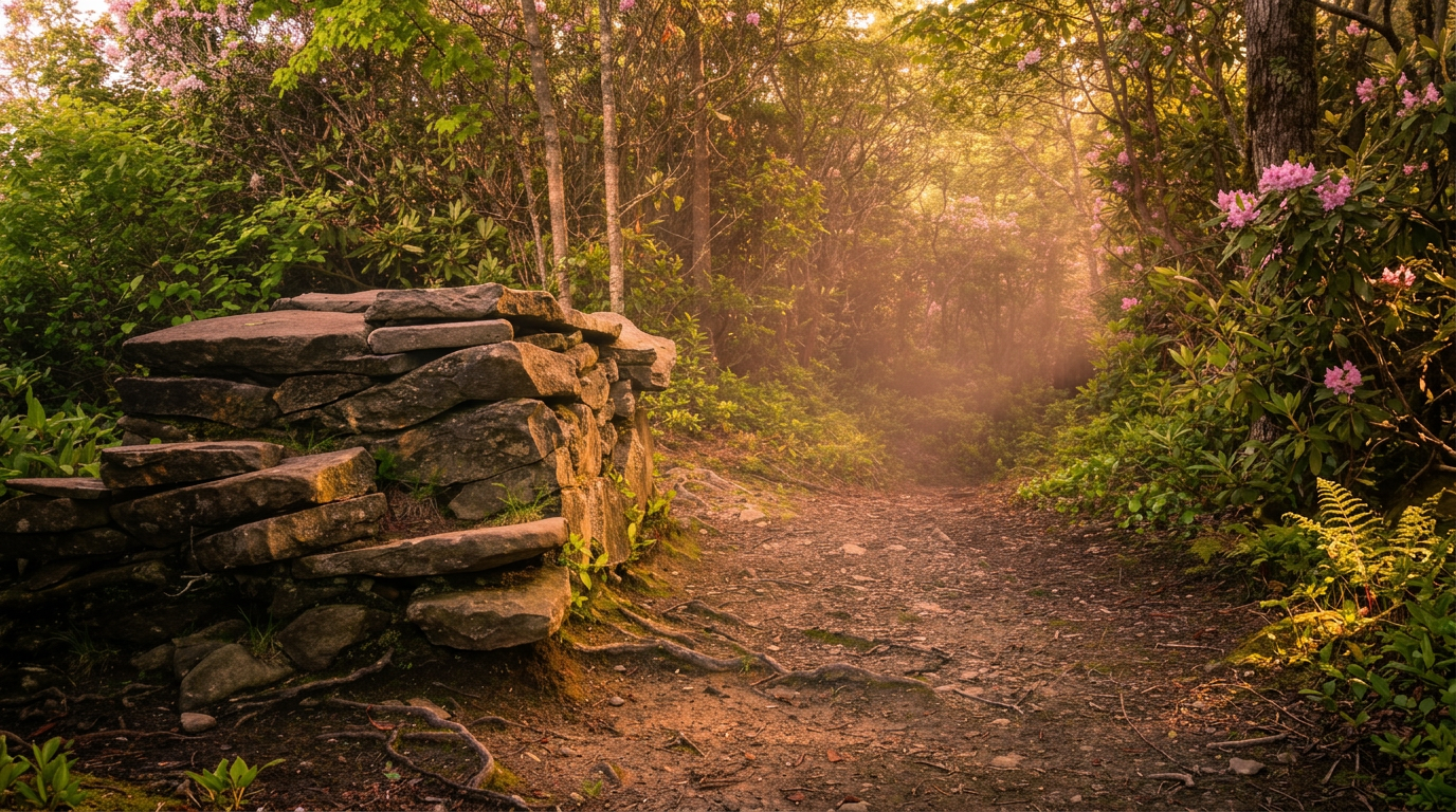
These 16 hikes made the cut because they're substantive; not day-strolls padded to a list, but actual long routes with real mileage and real elevation. The shortest here, Bote Mountain Trail, still runs 6.9 miles with 2,000 feet of climbing. At the other end, the Bartram Trail covers 100 miles and genuinely requires multi-day planning or several return trips to complete.
A few practical things worth knowing before picking your route:
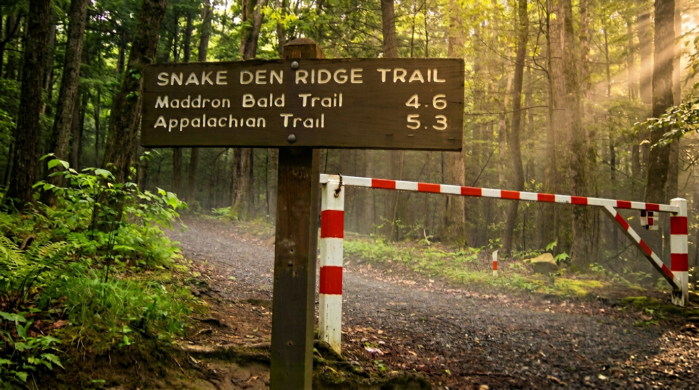
- Multi-trail systems like the Bartram, Benton MacKaye, and Appalachian Trail don't have a single trailhead. Each has distinct entry points with different parking situations, shuttle logistics, and permit requirements depending on where you stage.
- Park-It-Forward: Trails inside Great Smoky Mountains National Park require a $5 parking tag per vehicle, purchased online at recreation.gov or at self-registration kiosks near major trailheads. No national parks pass covers this fee.
- Trailhead crowds peak from mid-May through October, especially at Ramsey Cascades, Trillium Gap, and Alum Cave. Arriving before 8am or on a weekday cuts the parking scramble considerably.
- Weather at elevation runs colder and less predictable than valley readings suggest. Routes hitting Mount LeConte (Bullhead, Trillium Gap) can see clouds, wind, and temperatures well below freezing in shoulder months when Gatlinburg feels fine.
The trails split roughly into two categories: distance-focused routes where total mileage is the point (Old Settlers at 16 miles, Conasauga River at 13.5, the long AT corridor sections), and gain-focused routes where you're climbing hard for views or summits (Maddron Bald packs 3,000 feet into 7.1 miles; Bullhead pushes 3,800 feet into 13.8). Several manage both.
A few routes here sit outside GSMNP entirely. Panthertown Valley falls in Nantahala National Forest, the Conasauga River Trail in the Cohutta Wilderness, and the John Muir Trail runs along the Hiwassee River. The Park-It-Forward tag doesn't apply to those, though each has its own access rules and, in some cases, separate day-use fees.
Spring (late April through early June) brings peak wildflower bloom and high waterfall volume but also muddy conditions on lower trails. Fall color on the higher ridges peaks in mid-October. Some access roads close in winter, and upper trails can be icy from November through March.
- 1
Bartram Trail - Various Sections
100 mi · moderate
100-mile point-to-point, moderate hiking trail in Great Smoky Mountains National Park.
- 2
Benton MacKaye Trail (BMAT) - Various Sections
93 mi · moderate
93-mile point-to-point, moderate hiking trail in Great Smoky Mountains National Park.
- 3
Appalachian Trail (AT) - Various Sections
71 mi · strenuous
Appalachian Trail (AT) - Various Sections — 71 miles within GSMNP (point-to-point) trail, Strenuous (overall), sections vary.
- 4
Appalachian Trail (AT) - Fontana Dam to Cheoah Bald
30 mi · strenuous
30-mile point-to-point, strenuous hiking trail in Great Smoky Mountains National Park.
- 5
Panthertown Valley Trails (Nantahala National Forest)
30 mi · moderate
30-mile loop, moderate hiking trail in Great Smoky Mountains National Park. Highlights: "Yosemite of the East, " numerous waterfalls (Schoolhouse Falls.
- 6
Old Settlers Trail
16 mi · strenuous
16-mile point-to-point, strenuous hiking trail in Great Smoky Mountains National Park.
- 7
Bullhead Trail to Mount LeConte
13.8 mi · strenuous · 3,800 ft gain
13.8-mile out-and-back, strenuous, 3,800 ft gain hiking trail in Great Smoky Mountains National Park.
- 8
Trillium Gap Trail (to Grotto Falls and Mount LeConte)
13.6 mi · strenuous · 3,000 ft gain
13.6-mile out-and-back, strenuous, 3,000 ft gain hiking trail in Great Smoky Mountains National Park.
- 9
Conasauga River Trail (Cohutta Wilderness)
13.5 mi · moderate
13.5-mile point-to-point, moderate hiking trail in Great Smoky Mountains National Park.
- 10
John Muir Trail (Hiwassee River)
10.5 mi · moderate · 1,000 ft gain
10.5-mile point-to-point, moderate, 1,000 ft gain hiking trail in Great Smoky Mountains National Park.
- 11
Rich Mountain Loop Trail (Cades Cove)
8.5 mi · strenuous · 1,600 ft gain
8.5-mile loop, strenuous, 1,600 ft gain hiking trail in Great Smoky Mountains National Park.
- 12
Parson Branch Road Trail (Cades Cove)
8 mi · moderate
8-mile point-to-point, moderate hiking trail in Great Smoky Mountains National Park.
- 13
Ramsey Cascades Trail (Greenbrier)
8 mi · strenuous · 2,200 ft gain
8-mile out-and-back, strenuous, 2,200 ft gain hiking trail in Great Smoky Mountains National Park.
- 14
Boogerman Trail (Cataloochee Valley)
7.1 mi · strenuous · 1,000 ft gain
7.1-mile loop, strenuous, 1,000 ft gain hiking trail in Great Smoky Mountains National Park.
-
 15
15 Maddron Bald Trail
7.1 mi · strenuous · 3,000 ft gain
7.1-mile point-to-point, strenuous, 3,000 ft gain hiking trail in Great Smoky Mountains National Park.
- 16
Bote Mountain Trail
6.9 mi · strenuous · 2,000 ft gain
6.9-mile point-to-point, strenuous, 2,000 ft gain hiking trail in Great Smoky Mountains National Park.
Good to know
Best Full-Day & Long Hikes in the Smokies: FAQ
Do I need a permit or reservation for any of these hikes?
Is overnight camping allowed along these routes, and do I need a backcountry permit?
What's the best time of year for long hikes in the Smokies?
How do car shuttles work for the point-to-point trails on this list?
What are the main safety concerns on these longer routes?
Where to stay
Near the Smokies high country
Pick your spots, then lock in where you'll sleep. Compare live cabin, hotel, and rental prices nearby across Booking.com, Vrbo, and Expedia.
Map powered by Stay22. Prices and availability update live.
Keep exploring