
Trail guide
Best Hard Hikes in the Smokies
14 curated picks · verified 2026-05-28
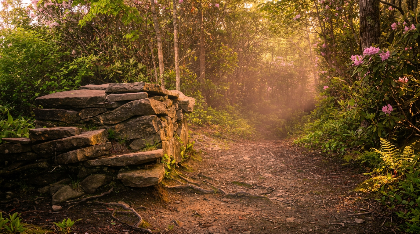
The trails on this list earned their strenuous rating honestly. Bullhead Trail hauls you 3,800 vertical feet over 13.8 miles before Mount LeConte's summit; Maddron Bald climbs 3,000 feet through old-growth coves that see a fraction of the traffic Alum Cave gets on a busy weekend. Even the shortest entry, the Kuwohi paved ramp at Clingmans Dome, sustains roughly a 12% grade from start to finish — something most visitors don't realize until they're already laboring at 6,300 feet.
Picks are ordered by elevation gain, the most reliable single predictor of how hard a hike actually feels. Distance matters, but a flat 8-mile loop and an 8-mile ascent of 3,000 feet are entirely different days. The four highest entries (Bullhead, Maddron Bald, Trillium Gap to LeConte, Ramsey Cascades) involve sustained climbing with no real flat recovery sections; budget 6–9 hours for any of them, more if weather is uncertain.
A few practical notes before you start planning:
- Parking: A Park-It-Forward parking tag is required at most GSMNP trailheads, with daily and weekly options sold at fee kiosks near major parking areas. Chimney Tops, Trillium Gap, and Ramsey Cascades trailheads fill well before 9am on summer weekends; arriving by 7:30am or after 4pm gives you the best odds at a spot.
- Seasonal conditions: Higher-elevation trails (the LeConte approaches, Maddron Bald, Kuwohi) can hold ice through April and again by November. Check the NPS trail conditions page before any early- or late-season hike.
- Timed entry: GSMNP has operated timed entry programs for certain road corridors during peak season, including Cades Cove (which serves the Rich Mountain Loop trailhead) and the Newfound Gap Road area. Confirm current requirements at the NPS website before your trip.
- Connectivity: Cell coverage is essentially nonexistent past the first mile on all 14 of these trails. Download offline maps and a weather forecast before you leave the car.
The park doesn't require the advance permit lotteries that gatekeep many western parks, which keeps these trails genuinely accessible to anyone who shows up prepared. The real barrier is parking and crowds at the marquee trailheads: Chimney Tops, Ramsey Cascades, Trillium Gap, and the Alum Cave corridor to LeConte. Maddron Bald, Gabes Mountain, Boogerman, and Little Cataloochee deliver comparable difficulty with significantly less company on the trail.
- 1
Bullhead Trail to Mount LeConte
13.8 mi · strenuous · 3,800 ft gain
13.8-mile out-and-back, strenuous, 3,800 ft gain hiking trail in Great Smoky Mountains National Park.
-
 2
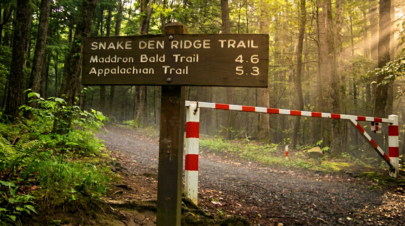
2 Maddron Bald Trail
7.1 mi · strenuous · 3,000 ft gain
7.1-mile point-to-point, strenuous, 3,000 ft gain hiking trail in Great Smoky Mountains National Park.
- 3
Trillium Gap Trail (to Grotto Falls and Mount LeConte)
13.6 mi · strenuous · 3,000 ft gain
13.6-mile out-and-back, strenuous, 3,000 ft gain hiking trail in Great Smoky Mountains National Park.
- 4
Ramsey Cascades Trail (Greenbrier)
8 mi · strenuous · 2,200 ft gain
8-mile out-and-back, strenuous, 2,200 ft gain hiking trail in Great Smoky Mountains National Park.
- 5
Bote Mountain Trail
6.9 mi · strenuous · 2,000 ft gain
6.9-mile point-to-point, strenuous, 2,000 ft gain hiking trail in Great Smoky Mountains National Park.
- 6
Gabes Mountain Trail
6.4 mi · strenuous · 2,000 ft gain
6.4-mile point-to-point, strenuous, 2,000 ft gain hiking trail in Great Smoky Mountains National Park.
- 7
Lower Mount Cammerer Trail
5.7 mi · strenuous · 2,000 ft gain
5.7-mile loop, strenuous, 2,000 ft gain hiking trail in Great Smoky Mountains National Park.
- 8
Big Frog Trail (Big Frog Wilderness)
5.5 mi · strenuous · 1,800 ft gain
5.5-mile out-and-back, strenuous, 1,800 ft gain hiking trail in Great Smoky Mountains National Park.
- 9
Rich Mountain Loop Trail (Cades Cove)
8.5 mi · strenuous · 1,600 ft gain
8.5-mile loop, strenuous, 1,600 ft gain hiking trail in Great Smoky Mountains National Park.
-
 10
10 Chimney Tops Trail
3.6 mi · strenuous · 1,400 ft gain
3.6-mile out-and-back, strenuous, 1,400 ft gain hiking trail in Great Smoky Mountains National Park.
-
 11
11 Balsam Mountain Trail
5.8 mi · strenuous · 1,300 ft gain
5.8-mile loop, strenuous, 1,300 ft gain hiking trail in Great Smoky Mountains National Park.
- 12
Boogerman Trail (Cataloochee Valley)
7.1 mi · strenuous · 1,000 ft gain
7.1-mile loop, strenuous, 1,000 ft gain hiking trail in Great Smoky Mountains National Park.
-
 13
13 Little Cataloochee Trail
6 mi · strenuous · 1,000 ft gain
6-mile point-to-point, strenuous, 1,000 ft gain hiking trail in Great Smoky Mountains National Park.
- 14
Kuwohi (Clingmans Dome) Paved Trail
1 mi · strenuous · 330 ft gain
1-mile out-and-back, strenuous, 330 ft gain hiking trail in Great Smoky Mountains National Park.
Good to know
Best Hard Hikes in the Smokies: FAQ
What does 'strenuous' actually mean on Smokies trails?
Do I need a permit or reservation to hike these trails?
When is the best time to tackle hard hikes in the Smokies?
Is Kuwohi (Clingmans Dome) really strenuous if it's only a mile?
How serious is the bear situation on these trails?
Where to stay
Near the Smokies high country
Pick your spots, then lock in where you'll sleep. Compare live cabin, hotel, and rental prices nearby across Booking.com, Vrbo, and Expedia.
Map powered by Stay22. Prices and availability update live.
Keep exploring